Citywide Intelligence Infrastructure
One camera network. The whole city in view.
Citywide Intelligence Infrastructure combines TrafficPulse, FloodDetect and CivicPulse on the cameras your city already owns. Traffic, flooding and crowds are watched around the clock, and every department works from the same real-time picture.
Three modules, one platform
TrafficPulse
Traffic intelligence: wrong-way drivers, vehicle counts and roadway events, alerted in real time.
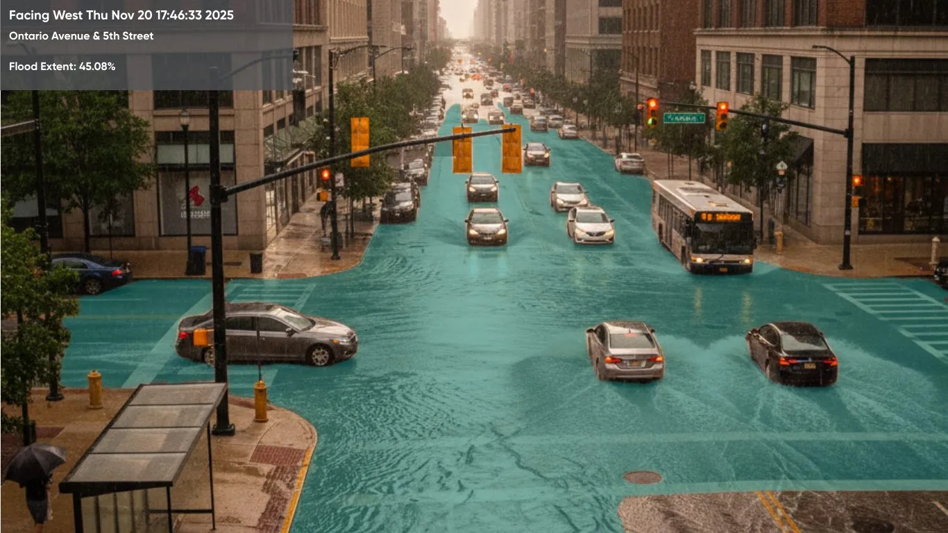
FloodDetect
Flood intelligence: water on the roadway mapped and measured, with alerts before anyone calls it in.
CivicPulse
Crowd intelligence: pedestrian density and movement in public spaces, transit and events.
Why one network
Buy the platform once. Every module after that reuses it.
Cities already pay to install and maintain thousands of cameras, and most of them are watched by no one. Citywide Intelligence Infrastructure puts them to work without new poles, sensors or trenching.
Every module shares the same camera connections, the same pipeline and the same data layer, so adding flood or crowd awareness to a TrafficPulse deployment is a matter of activating a model, not starting a new project.
- Connects to traffic, 511, security, transit and municipal camera feeds you already have
- Detections become structured data with location, time and the evidence frame
- Alerts reach your TMC, dispatch, message signs, email and SMS
- Proven at scale: the platform monitors more than 900 traffic cameras citywide for a major U.S. municipal agency
Who it serves
Every department sees the same picture
- 01
Traffic operations
Wrong-way drivers, stopped vehicles and flooded roads flagged on every camera, with reroutes posted to signs and 511.
- 02
Emergency management
One view of where water is rising and where crowds are building, so units are staged in the right places.
- 03
Public works
Crews and pumps go to the intersections that are actually flooded, and repeat hotspots point to drainage to fix.
- 04
Events and public safety
Crowd density and movement around venues, transit and downtown, with alerts when conditions cross a threshold.
- 05
Planning and engineering
Continuous traffic, flood and crowd history for capital planning, policy and grant applications such as SS4A.
Start where it hurts most
Begin with one module and expand on the same cameras
Most cities start with the problem that costs them the most, such as wrong-way drivers on a highway corridor or flooding at the same intersections every storm, and add modules as the value shows. ClearHeight for bridge strikes and ClearWorkZone for crew safety run on the same platform too.
See all productsCan’t wait? Contact us today.
The ClearObject team of AI experts is here to help you map your camera network and pick where to start.
Talk to an expert